

+ 22
Kendrick Peak (#22, Trail 22)
Hiking Trail
Hard
8.57 mi
2,701 ft
Hike to one of the highest peaks in the state on this difficult and underrated hike northwest of Flagstaff.
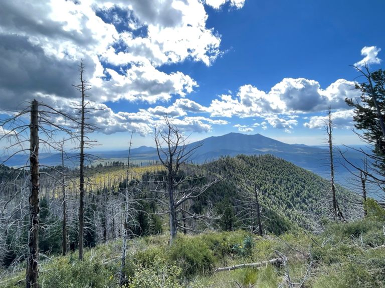
As the 11th or 12th highest peak in Arizona (depending on the source), this route to the summit of Kendrick Peak awards epic views, opportunities to see elk and mule deer, and a fire lookout tower atop the 10,400-foot summit. A great alternative to the popular [Humphreys Peak]( hike, this 9ish-mile route meanders up the southern slopes of the mountain, passing through open meadows, fields of wildflowers, and alongside scarred Ponderosa Pine that burned in a wildfire in 2000. The peak is also one of several dome volcanos in the San Fransisco volcanic field, similar to Mount Elden, Bill Williams Mountain, and Sitegreaves Mountain, according to [this source](
Surrounded by the Kendrick Mountain Wilderness, this hike offers tons of solitude compared to many others around Flagstaff. A manned and active fire tower awards commanding views from the summit, though it is only open in the summer months. Near the summit, you should also take time to appreciate the subtle changes in flora and fauna, particularly the Colorado Pinyon, Englemann Spruce, and limber pine that tend to grow at the highest elevations. According to [Wikipedia]( the mixture of plant life near Kendrick Peak is a rare occurrence in the region.
The trailhead for this hike is located off of Forest Road 190, which exists almost exclusively to access the Kendrick Trailhead. The primitive parking area is located off of a maintained dirt road, and most passenger vehicles shouldn't have any problem with ground clearance. There is no drinking water or facilities at the trailhead and no reliable water on the trail, the USFS notes.
Sources:
Written by Brendon Voelker
Route and Elevation
Segments
| Name | Distance | Elev. Diff. | Avg. Grade |
|---|---|---|---|
| Forest Service Road 190 Climb | 0.53 mi | 233 ft | 8.2% |
| Forest Service Road 190 Climb | 4.26 mi | 2,425 ft | 10.8% |
| Kendrick Ascent | 4.40 mi | 2,651 ft | 11.4% |
| Forest Service Road 190 Climb | 0.39 mi | 262 ft | 12.3% |