


+ 119
Squaw Peak and Emigrant Peak Loop
Hiking Trail
Details
5.12 mi
1,458 ft
Hike through meadows and along ridgelines to reach the peaks at the top of Palisades Tahoe.
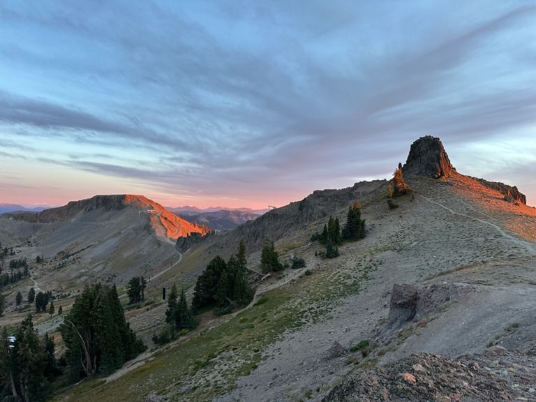
Riding the tram up to High Camp, you’ll gaze over many rocky outcrops of Palisades Tahoe, and at craggy peaks rising on every side. The tram unloads at 8,200 feet elevation, but the tallest summits remain much higher. The way to reach them is on foot, and the effort pays off with panoramas over Lake Tahoe and the Sierra Nevada.
This loop from High Camp connects Emigrant Peak (8,774’) and Squaw Peak (8,885’). If you don’t have time for both, you can, of course, visit one or the other to shorten the trip and save energy for other activities at High Camp. The walk begins on a narrow path through an alpine meadow, where yellow flowers bloom in summer, even as snow lingers in patches on the slope. Moving upward toward Emigrant Peak, you’ll join a dirt road on a ridgeline with views to nearby mountains, and to the blue water of Lake Tahoe in the distance.
From Emigrant Peak, the trail dips down then back up to reach Squaw Peak. Here you’ll see The Palisades–cliff bands that are famous for daring ski lines in the winter. Squaw Peak’s flat summit overlooks all of the resort, including your starting point far below. To continue the loop, backtrack a little to follow a wide path beneath The Palisades, then down the other side of a colorful alpine basin to eventually return to High Camp.
Sources:
Written by Jesse Weber
Created By
Strava Routes
