

+ 23
Muir Woods Canopy View Loop (Canopy View to Lost Creek to Fern Creek Loop)
Hiking Trail
Easy
3.29 mi
596 ft
A beautiful loop connecting some of the best trails among the towering redwood trees in Muir Woods National Monument.
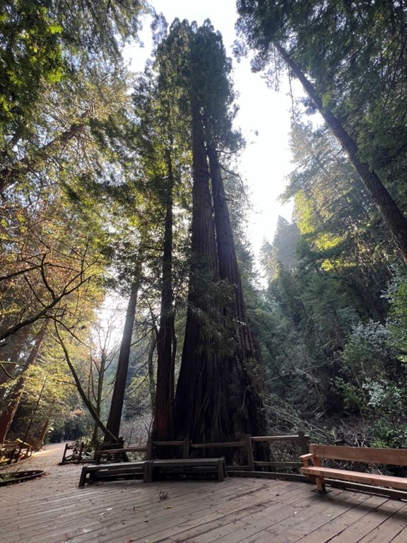
Muir Woods National Monument is a small plot of public land that protects some of the oldest and largest trees in the Bay Area. The famous residents are coastal redwoods, which grow to be taller than any other tree on Earth. Many trees in Muir Woods reach higher than 200 feet and are nearly 1,000 years old. They are protected here even though similar forests have been cut down in much of California. Therefore, Muir Woods is one of the best places in the state to see an intact old-growth forest.
The national monument contains about 6 miles of trails, but they connect to a much larger trail network in Mount Tamalpais State Park. The Main Trail within the monument is a paved, ADA-accessible loop along Redwood Creek. The loop described here uses part of this path, but makes a longer and more moderate-difficulty route to explore more of the forest. This is merely one combination out of many that are possible on the trails here, but it is an especially good one for the amount you will see over the course of the hike.
Begin on the Main Trail then follow Canopy View, a dirt path that heads uphill. Roots, rocks, logs, and steps make small obstacles, but the trail is well maintained, and handrails aid the narrow sections. It ascends gradually but significantly, crossing a few narrow, steep drainages on a hillside draped in ferns under a ceiling of towering trees. In some places, you must use a footbridge to cross over massive downed logs. These are left in place to preserve the natural life cycle of the forest.
At the junction with Lost Trail, take it to drop in elevation and meet with Fern Creek Trail in a particularly deep and lush ravine. The creek trickles with water most of the year and nourishes a community of plants so diverse that it resembles a rainforest. Moss clings to nearly every surface, ferns and clover spread over the ground, and trees branch out in every level of the canopy.
After descending Fern Creek, you’ll meet again with the paved Main Trail in an even deeper and denser grove along Redwood Creek. This is where the majority of the park’s visitors hike. If it’s not too crowded, take time to read the informative signs and admire the giant trees that surround you as you return to the parking area.
Note that parking at Muir Woods is by reservation only. You can also access Muir Woods by public shuttle, which also requires a reservation. Arrange your parking or shuttle at []( before you visit.
Sources:
Written by Jesse Weber
Route and Elevation
Segments
| Name | Distance | Elev. Diff. | Avg. Grade |
|---|---|---|---|
| Ridge Ave Climb | 0.24 mi | 230 ft | 17.4% |
| Canopy View tr - Fern Creek to Lost tr | 1.28 mi | 561 ft | 8.3% |