


+ 24
Trail 10
Hiking Trail
Moderate
6.69 mi
128 ft
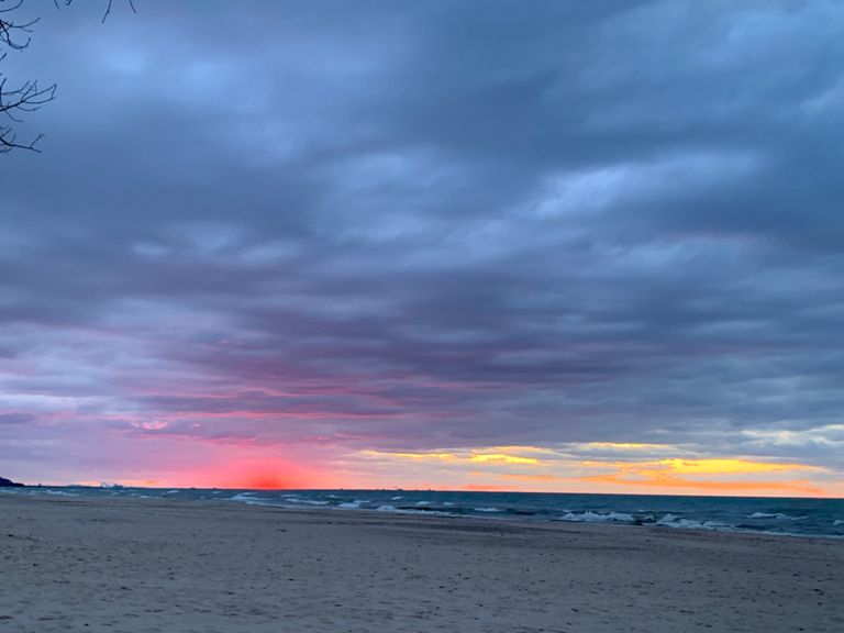
Hike through quiet, serene forests, then follow sand dunes along Lake Michigan back to the trailhead.
Trail 10 is one of the longer hikes in Indiana Dunes State Park, first wandering through serene forests and along a boardwalk before returning along the shores of Lake Michigan. Along the way, you will pass through stands of white pine and lush forests lined with summer wildflowers, plus a "tree graveyard" in Big Blowout. Though it can be hiked any time of day, it is noted as the perfect option for an early morning hike - the sun rising to your back as you follow the sand dunes back to the trailhead. As mapped, this route begins at the main beach parking area for the State Park. You could also begin anywhere in the campground or in the main parking area by the entrance gate. Several picnic areas are also located not far from where the hike begins. Both drinking water and restrooms can be found scattered throughout the park and at its furthest point near the East Park Boundary Road - also known as the Dune Ridge Trailhead. From the main beach parking lot, you will begin with a short walk down the Beach Trail before entering the State Park Campground. It can be tricky to make your way through, so stick close to this mapped route and be sure you **do not** to turn onto Trails 7, 8, or 9. After the junction with Trail 9, Trail 10 is well marked for the remainder of the hike. To shorten this hike, consider returning on Trails 2 or 9—both return to the trailhead. A route pairing Trails 10 and 2 [can be seen here]( [Source]( Written by Brendon Voelker
Trail 10 is one of the longer hikes in Indiana Dunes State Park, first wandering through serene forests and along a boardwalk before returning along the shores of Lake Michigan. Along the way, you will pass through stands of white pine and lush forests lined with summer wildflowers, plus a "tree graveyard" in Big Blowout. Though it can be hiked any time of day, it is noted as the perfect option for an early morning hike - the sun rising to your back as you follow the sand dunes back to the trailhead. As mapped, this route begins at the main beach parking area for the State Park. You could also begin anywhere in the campground or in the main parking area by the entrance gate. Several picnic areas are also located not far from where the hike begins. Both drinking water and restrooms can be found scattered throughout the park and at its furthest point near the East Park Boundary Road - also known as the Dune Ridge Trailhead. From the main beach parking lot, you will begin with a short walk down the Beach Trail before entering the State Park Campground. It can be tricky to make your way through, so stick close to this mapped route and be sure you **do not** to turn onto Trails 7, 8, or 9. After the junction with Trail 9, Trail 10 is well marked for the remainder of the hike. To shorten this hike, consider returning on Trails 2 or 9—both return to the trailhead. A route pairing Trails 10 and 2 [can be seen here]( [Source]( Written by Brendon Voelker
Created By
Strava Routes
