

+ 93
Bubbles Nubble Loop (Eagle Lake Trail, Bubbles Divide, Jordan Pond Carry, Conners Nubble)
Hiking Trail
Hard
4.14 mi
1,114 ft
A circuit including North Bubble, South Bubble, and Conners Nubble - with impressive views from each.
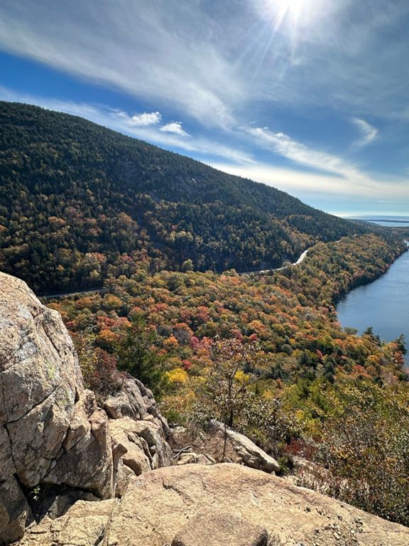
Nicknamed the "Bubbles Nubble Loop" by the NPS, this loop links the exposed granite summits of North and South Bubble with the lesser-visited views atop Conners Nubble to the north. Along the way, you will enjoy views of nearby Eagle Lake and Jordan Pond, while views to the south stretch as far as Cranberry Isles. Best between spring and fall, the park notes how this hike is a spectacular option during peak fall foliage. This hike begins slightly north of Jordan Pond at the Bubbles Divide Trailhead. Set aside at least 4 hours for the loop and be extra cautious during wet weather as the granite ledges can be both slick and dangerous. To shorten the hike by more than half, a popular option is to forego Conners Nubble for an out and back to North and South Bubble, [seen here]( [Source]( Written by Brendon Voelker
Nicknamed the "Bubbles Nubble Loop" by the NPS, this loop links the exposed granite summits of North and South Bubble with the lesser-visited views atop Conners Nubble to the north. Along the way, you will enjoy views of nearby Eagle Lake and Jordan Pond, while views to the south stretch as far as Cranberry Isles. Best between spring and fall, the park notes how this hike is a spectacular option during peak fall foliage. This hike begins slightly north of Jordan Pond at the Bubbles Divide Trailhead. Set aside at least 4 hours for the loop and be extra cautious during wet weather as the granite ledges can be both slick and dangerous. To shorten the hike by more than half, a popular option is to forego Conners Nubble for an out and back to North and South Bubble, [seen here]( [Source]( Written by Brendon Voelker
Route and Elevation
Segments
| Name | Distance | Elev. Diff. | Avg. Grade |
|---|---|---|---|
| Bubbles divide to South Bubble | 0.61 mi | 292 ft | 8.9% |
| North Bubble (from the South) | 0.31 mi | 299 ft | 17.4% |
| Unnamed Road Climb | 0.19 mi | 148 ft | 14.5% |
