

+ 112
Corona Arch
Hiking Trail
Easy
2.26 mi
473 ft
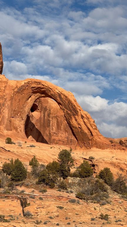
A short hike to a massive freestanding arch.
The hike to Corona Arch is only 1.2 miles long, for a roundtrip total of 2.4 miles. The route is well marked and is fairly easy for most people to complete. The hike is a good one for families, but may not be suited to those with a fear of heights or who may have difficulties with negotiating some scrambling, ladder climbing, or off-camber slickrock.
As with any hikes in the Moab area, the trek to Corona Arch can be extremely hot in the summer. It is best to do this in spring or fall when it is a more tolerable temperature. Even then, be prepared for intense sun exposure with sunscreen, hat and plenty of water!
The hike begins with a short climb on a rocky trail before crossing a railroad track. The tracks are active, so use caution when crossing.
The next portion of the trail is an old roadbed alongside and below high cliff walls that provide plenty of dramatic views. The trail then becomes a rocky scramble up a canyon before emerging on an expanse of slickrock.
For those with a fear of heights, or not nimble enough to navigate off camber rock slabs, the next part of the route may not be do-able. The exposure and slickrock navigating is, however, mitigated by fixed cables to hold onto and even a metal ladder to get up and over a large rock ledge.
After climbing the ladder, the trail rounds a curve where the first view of Corona Arch is seen. The route takes hikers across a rock bench that passes under the impressive Bow Tie Arch before arriving at Corona Arch. Bow Tie would be a worthy destination in and of itself if Corona wasn't there to steal the show!
Continuing on past Bow Tie Arch, the views of Corona Arch become increasingly stunning. The only way to fully appreciate the full magnitude of Corona's size is to stand below it. The 140' x 105' arch opening gives one a true sense of how insignificant humans are in comparison.
The Corona Arch trailhead is located on UT 279, across from the Gold Bar Campground. This gorgeous arch is not in Arches National Park, so it sees far fewer hikers than those in the park. It is on BLM land and is open to the public. Written by Scott Anderson
