

+ 17
Bald Mountain via Ontario Canyon Trail (Bald Mountain via Ontario Canyon Trail)
Hiking Trail
Hard
4.98 mi
1,289 ft
Hike through forest and along grassy ski slopes to the summit of Bald Mountain in Deer Valley Resort.
Deer Valley, though best known for skiing in the winter, is also a popular destination for summer trails. Most of the mountain caters to biking, but a few hiker-only trails allow you to enjoy the scenery at a slower pace. Ontario Canyon is one of them. It starts at Silver Lake Lodge and finishes on the panoramic summit of Bald Mountain, at 9,400 feet elevation. Together with Silver Lake Trail it makes a 5-mile loop for hiking a full tour of this iconic mountain.
To begin Ontario Canyon Trail, take the Silver Lake Express chair (fee required) or the free shuttle from Park City Transit to Silver Lake Village. If you prefer to ride to the summit and hike Ontario Canyon back down, take Sterling Express. To hike uphill, find the Ontario Canyon trail at the busy crossroads near the lodge, then follow it into the forest.
Sounds soften as soon as you enter the trees, and grow even quieter as you continue uphill. The occasional whiz of a biker on a nearby trail is all you’ll hear in addition to chirping birds and rustling aspen leaves. Keep an eye out for wildlife like deer, squirrels, and hawks. It’s even possible to spot moose here.
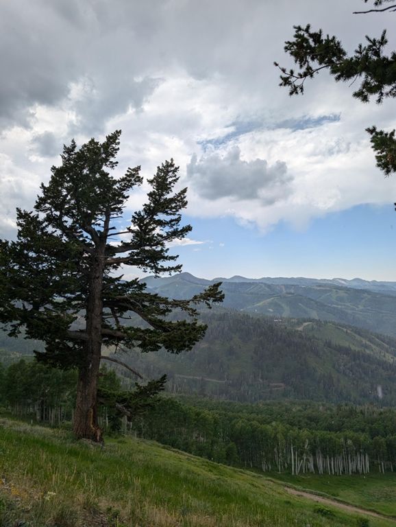
The trail winds gradually upward with occasional steeper sections, crossing a few dirt roads and bike trails. In clearings you’ll catch a great view down the canyon to Silver Lake Village and the valley beyond. You’ll pass a snowmaking reservoir, then dip briefly back into the trees before a final climb through a steep meadow, with the summit in sight.
On a clear day atop Bald Mountain you can see quite a long way in many directions. The Wasatch Range is on one side and the Provo River Valley, with Jordanelle Reservoir, is on the other. The Uinta Mountains make up the eastern horizon.
Return the way you came or complete the loop with the Silver Lake Trail. If you prefer not to hike downhill, you can hop on the Sterling Express lift for free from the top and ride it down.
Sources:
Written by Jesse Weber
Route and Elevation
Segments
| Name | Distance | Elev. Diff. | Avg. Grade |
|---|---|---|---|
| Reservoir to Top of Bald Mountain | 1.13 mi | 482 ft | 8.1% |
