

+ 194
Wonderland Trail
Hiking Trail
Hard
85.34 mi
24,821 ft
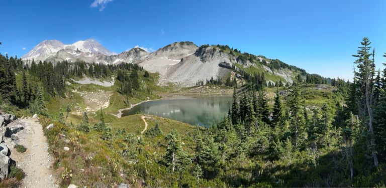
A 93 mile (150 kilometer) hiking trail that circumnavigates Mount Rainier, one of North America's most iconic peaks.
Built back in 1915 and taking in 22,000 feet (6,700 metres) of elevation gain, this is a tough and historic journey that most hikers complete in 2 weeks-ish. Once underway the trail is rarely flat as it climbs and descends the various flanks of Rainier (including Panhandle Gap, which at 2600 metres is the highest altitude the trail reaches) but the constant effort is rewarded by a continual change of scenery, from deep forested valleys to sub-alpine meadows. There are 18 campsites on the trail, roughly 3 to 7 miles (5 to 11 kilometres) apart and these are unfailingly stunning. Every camp has cleared tent sites, a pit or composting toilet, bear pole for hanging food, and a nearby water source. A backcountry permit, including reservations for designated camping areas, is required to hike the Wonderland Trail and these can be obtained here - Written by Charlie Boscoe
Built back in 1915 and taking in 22,000 feet (6,700 metres) of elevation gain, this is a tough and historic journey that most hikers complete in 2 weeks-ish. Once underway the trail is rarely flat as it climbs and descends the various flanks of Rainier (including Panhandle Gap, which at 2600 metres is the highest altitude the trail reaches) but the constant effort is rewarded by a continual change of scenery, from deep forested valleys to sub-alpine meadows. There are 18 campsites on the trail, roughly 3 to 7 miles (5 to 11 kilometres) apart and these are unfailingly stunning. Every camp has cleared tent sites, a pit or composting toilet, bear pole for hanging food, and a nearby water source. A backcountry permit, including reservations for designated camping areas, is required to hike the Wonderland Trail and these can be obtained here - Written by Charlie Boscoe
Route and Elevation
Segments
| Name | Distance | Elev. Diff. | Avg. Grade |
|---|---|---|---|
| Wonderland Trail Climb | 0.62 mi | 164 ft | 5.0% |
| Paradise Rd E Climb | 0.83 mi | 246 ft | 5.5% |
| Paradise Rd E Climb | 0.30 mi | 174 ft | 11.1% |
| Stevens Canyon Road Climb | 0.72 mi | 371 ft | 9.5% |
| Wonderland Trail Climb | 0.40 mi | 203 ft | 9.5% |
| Climb to Frozen Lake | 0.50 mi | 387 ft | 14.6% |
| Wonderland Trail Climb | 0.59 mi | 226 ft | 7.0% |
| Ipsut pass climb | 3.61 mi | 2,589 ft | 13.5% |
| Ipsut Pass Grind | 1.57 mi | 1,358 ft | 16.3% |
| Wonderland Trail Climb | 0.45 mi | 259 ft | 10.8% |
