
+ 1
Electric Peak
Hiking Trail
Hard
18.44 mi
4,351 ft
For sweeping views of the entire northwest corner of Yellowstone, Electric Peak is well worth the climb.
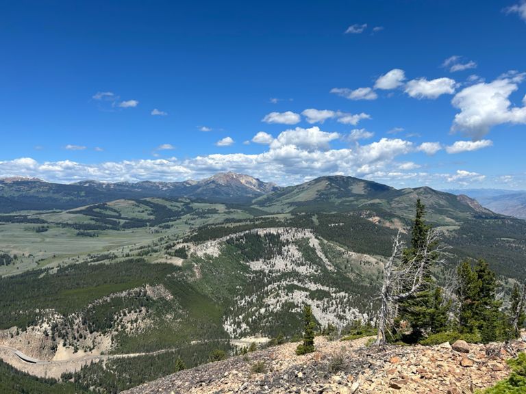
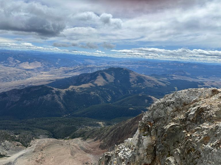
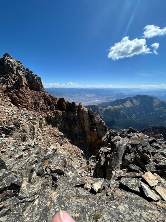
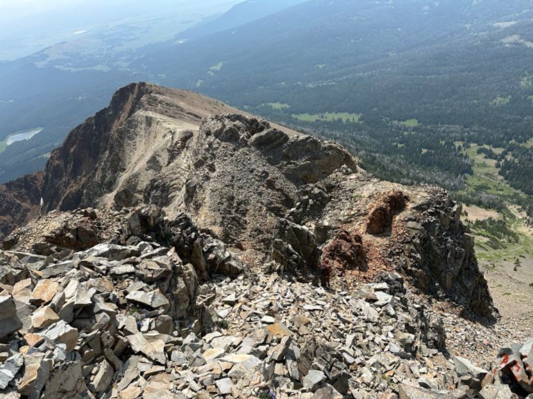
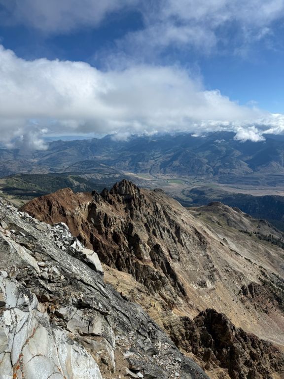
At nearly 11,000 feet, Electric Peak is the giant in Yellowstone’s northwest corner. From the summit, you get uninterrupted views across the plains and forests below and out as far as the distant mountain ranges: the Crazies, Beartooths, Madisons, and Tetons. This out-and-back is around 20 miles in total, taking you on a mixed journey through sagebrush grasslands, plains and forests before summiting Electric Mountain. The trek is achievable in one day, but there are also nice backcountry campsites along the way if you want to take it at a more leisurely pace. *Directions:* Begin at the Glen Creek Trailhead, on the south side of Kingman Pass, just bellow Rustic Falls. Drop your car in the Bunsen Peak parking area, heading back down the highway a little on foot where you need to cross Glen Creek to reach the trailhead. For 6.2 miles the trail follows Glen Creek, through sagebrush grasslands and across flat plains until arriving at a junction with the Electric Peak-Southeast Ridge Trail. As you wander across the plains you will be able to see the imposing Electric Peak directly before you. Following the trail through a ravine, you begin to climb up a steady 700-feet over the next 4-miles. Watch out for moose and bison along the way! Continue following Glen Creek upstream, past the plains, and entering a Douglas fir. Forest. Leaving the forest you will come to a 3-way junction at mile 6, where you need to continue straight on to the campsites 1G3 or 1G4 if you plan to spend the night. The next day, make your way back to the junction, where you need to turn right onto the Electric Peak-Southeast Ridge Trail. For the first mile of this next stretch, you will be lead along a relatively flat path through meadows and patchy forests before hitting a dramatic climb overlooking the Gardiner River. In the next 2 miles, the trail ascends nearly 3,000 feet along the rocky southeast ridge. Climbing up the path through barren, rocky land, which gets intensely steeper, and for the last burst, you will really have to push it, as you scramble over piles and piles of loose red rock. During this section of the trek you will be crossing over the boundary between Wyoming and Montana, and traversing the 45th parallel of latitude, halfway between the North Pole and the Equator. After 9.5 miles, you will crest Electric Peak summit, where you can take in the spectacular views, relax, and put your name in the sign-in box, joining all the other adventurers who reached the top of Electric Peak. Once rested, turn around and head back the way you came! *Tips* Funnily enough, Electric Peak is prone to lightning strikes and dramatic storms, especially in the afternoon. So it's advised to summit Electric Peak before noon. Making it a sunrise summit is even better. You will need to reserve one of the backcountry campsites in the Upper Gardiner River Valley. Check the Yellowstone National Park [website](https://www.nps.gov/yell/index.htm) or ask at the visitor center to find out how. Sources: https://www.backpacker.com/trips/yellowstone-national-park-electric-peak https://sunlightsports.com/hiking-electric-peak/ https://www.nps.gov/yell/index.htm https://www.hikingproject.com/trail/7017495/electric-peak Written by FATMAP Official
At nearly 11,000 feet, Electric Peak is the giant in Yellowstone’s northwest corner. From the summit, you get uninterrupted views across the plains and forests below and out as far as the distant mountain ranges: the Crazies, Beartooths, Madisons, and Tetons. This out-and-back is around 20 miles in total, taking you on a mixed journey through sagebrush grasslands, plains and forests before summiting Electric Mountain. The trek is achievable in one day, but there are also nice backcountry campsites along the way if you want to take it at a more leisurely pace. *Directions:* Begin at the Glen Creek Trailhead, on the south side of Kingman Pass, just bellow Rustic Falls. Drop your car in the Bunsen Peak parking area, heading back down the highway a little on foot where you need to cross Glen Creek to reach the trailhead. For 6.2 miles the trail follows Glen Creek, through sagebrush grasslands and across flat plains until arriving at a junction with the Electric Peak-Southeast Ridge Trail. As you wander across the plains you will be able to see the imposing Electric Peak directly before you. Following the trail through a ravine, you begin to climb up a steady 700-feet over the next 4-miles. Watch out for moose and bison along the way! Continue following Glen Creek upstream, past the plains, and entering a Douglas fir. Forest. Leaving the forest you will come to a 3-way junction at mile 6, where you need to continue straight on to the campsites 1G3 or 1G4 if you plan to spend the night. The next day, make your way back to the junction, where you need to turn right onto the Electric Peak-Southeast Ridge Trail. For the first mile of this next stretch, you will be lead along a relatively flat path through meadows and patchy forests before hitting a dramatic climb overlooking the Gardiner River. In the next 2 miles, the trail ascends nearly 3,000 feet along the rocky southeast ridge. Climbing up the path through barren, rocky land, which gets intensely steeper, and for the last burst, you will really have to push it, as you scramble over piles and piles of loose red rock. During this section of the trek you will be crossing over the boundary between Wyoming and Montana, and traversing the 45th parallel of latitude, halfway between the North Pole and the Equator. After 9.5 miles, you will crest Electric Peak summit, where you can take in the spectacular views, relax, and put your name in the sign-in box, joining all the other adventurers who reached the top of Electric Peak. Once rested, turn around and head back the way you came! *Tips* Funnily enough, Electric Peak is prone to lightning strikes and dramatic storms, especially in the afternoon. So it's advised to summit Electric Peak before noon. Making it a sunrise summit is even better. You will need to reserve one of the backcountry campsites in the Upper Gardiner River Valley. Check the Yellowstone National Park [website](https://www.nps.gov/yell/index.htm) or ask at the visitor center to find out how. Sources: https://www.backpacker.com/trips/yellowstone-national-park-electric-peak https://sunlightsports.com/hiking-electric-peak/ https://www.nps.gov/yell/index.htm https://www.hikingproject.com/trail/7017495/electric-peak Written by FATMAP Official