

+ 15
North Dome Loop (North Dome via Porcupine Creek Trailhead)
Hiking Trail
Hard
9.65 mi
2,155 ft
Forest hike to the rim of Yosemite Valley at one of its greatest viewpoints
North Dome is one of Yosemite’s lesser-known but more spectacular viewpoints. It is a granite dome perched on the north rim of the Valley that stares directly across at the vertical face of Half Dome. The hike is not especially long or difficult, but begins from a rather nondescript trailhead along Tioga Road, that for some reason does not receive the same attention as other trails in the area.
The journey to North Dome is mapped here as a lariat loop that returns through the Lehamite Creek Valley, but the simple out-and-back is a fine option too, resulting in a slightly shorter hike. Hiking the loop provides the option for a side-trip extension to Yosemite Point and/or Yosemite Falls, both highly worthwhile if you have the time and energy.
Begin from Porcupine Creek Trailhead, where a sign marks the mileage to North Dome, Yosemite Falls, and the floor of the Valley. This wide dirt path leads through shady conifer forest over rolling terrain, with a few small stream crossings. An uphill portion leads to more open forest and glimpses to the Valley rim ahead through the trees. At a signed trail junction, you’ll have the option to take a steep side trail up Indian Rock (not mapped), where you can find a view of Half Dome through the window of a natural arch.
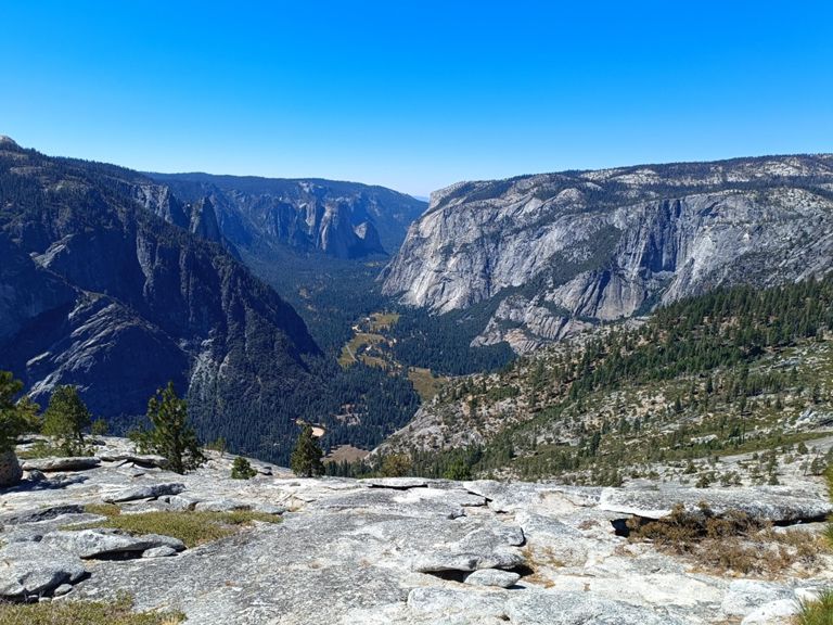
Continuing toward North Dome, the trail goes through more forest on mellow terrain before emerging to a panorama on a sloped spine of granite. This is where you’ll stare Half Dome right in the face. It stands in stalwart counterpoise directly across the Valley. This is the trail’s highpoint and makes a good turnaround point if you’re satisfied with the view, but a more expansive view of the Valley awaits by descending the ridge then making the short ascent of North Dome. From there you’ll look directly across to Glacier Point and Sentinel Dome, and you’ll see the Valley to the west in perfect frame between to Eagle Peak on the north rim and Cathedral Rocks on the south rim.
Backtrack from North Dome to the main ridgeline, then turn left to complete the lasso loop. A downhill jaunt leads to Lehamite Creek, close to, but not in view of, the top of Lehamite Falls. Cross the creek and hit the Yosemite Falls Trail. Left leads to the falls and more viewpoints along the rim, right completes the loop by gently ascending through the forested creek valley.
Sources:
Written by Jesse Weber
Route and Elevation
Segments
| Name | Distance | Elev. Diff. | Avg. Grade |
|---|---|---|---|
| Porcupine Creek to North Dome | 3.64 mi | -387 ft | -1.5% |
| North Dome | 1.17 mi | -203 ft | -0.1% |
| Ahwahnee Dr Climb | 0.25 mi | 135 ft | 9.9% |
| Ahwahnee Dr Climb | 0.27 mi | 203 ft | 14.3% |
| California 120 Climb | 0.29 mi | 138 ft | 8.9% |
| Tioga Pass Rd Climb | 0.69 mi | 312 ft | 8.5% |
