
+ 38
Crestone Needle
Hiking Trail
Hard
11.18 mi
5,847 ft
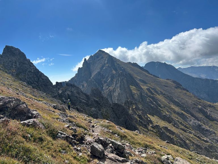
One of the most aesthetic and challenging Colorado 14ers.
*Note: this route warrants a "Moderate" Mountaineering difficulty rating.*
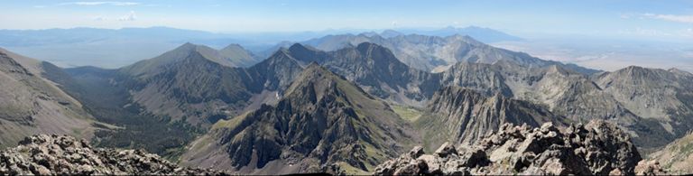
While Crestone Needle and Crestone Peak are renowned as two of the most beautiful, most formidable, and most technical 14ers in Colorado, if you stick to the standard routes, you can tackle each peak individually with a Class 3 climb. "Among the last of the fourteeners to be scaled. . .this remote and rugged mountain was once thought impossible to climb," writes Matt Lemke on [SummitPost.org](https://www.summitpost.org/crestone-peak/150435).
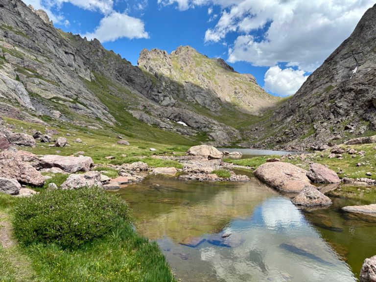
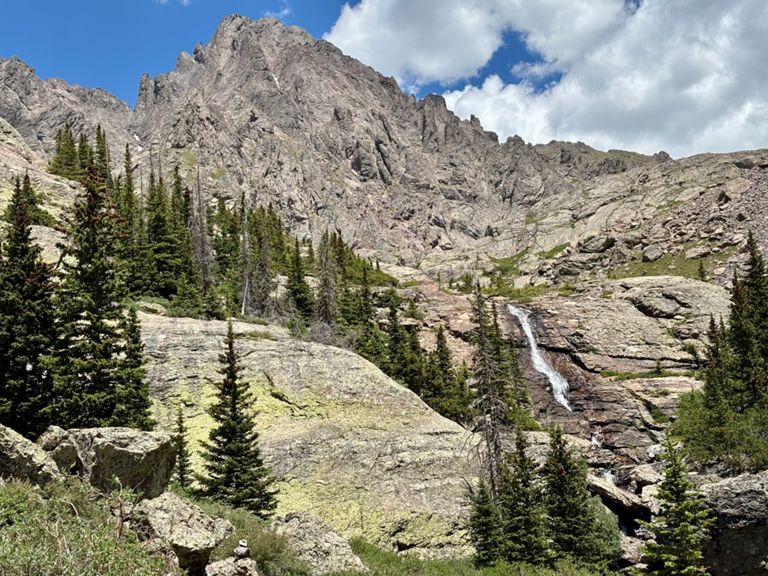
To begin the standard route up the south face, begin by following the gated 4x4 road to the approach trail. After hopping on the singletrack trail, you'll gain a low pass and face your main ascent.
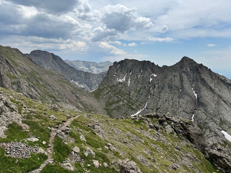
The main objective is to "traverse into a large gully, climb a few hundred feet, cross west over a rib, and ascend a second gully to the summit ridge," according to [14ers.com](https://www.14ers.com/route.php?route=cnee1&peak=The+Crestones+and+Humboldt+Peak). If you follow this crossover route, you'll be able to stick to solely Class 3 terrain. Following this route requires very careful route-finding, provided by either astute awareness of the mountains around you, climbing with someone who's completed the route before, or following careful turn-by-turn directions, linked above on 14ers.com. The route mapped here in FATMAP should be very, very close to the intended route, but be sure to remain situationally aware while on the mountain.
One route variation climbs straight up the east gully to the summit, instead of switching over to the west gully. While it's a more direct climb than the crossover route, this variation is more difficult and more technical, resulting in Class 4 scrambling. This would effectively bump the FATMAP rating up from "moderate" to "difficult."
Sources:
https://www.summitpost.org/crestone-peak/150435
https://www.summitpost.org/crestone-needle/150434
https://www.14ers.com/route.php?route=cnee1&peak=The+Crestones+and+Humboldt+Peak Written by Greg Heil
*Note: this route warrants a "Moderate" Mountaineering difficulty rating.*
While Crestone Needle and Crestone Peak are renowned as two of the most beautiful, most formidable, and most technical 14ers in Colorado, if you stick to the standard routes, you can tackle each peak individually with a Class 3 climb. "Among the last of the fourteeners to be scaled. . .this remote and rugged mountain was once thought impossible to climb," writes Matt Lemke on [SummitPost.org](https://www.summitpost.org/crestone-peak/150435).
To begin the standard route up the south face, begin by following the gated 4x4 road to the approach trail. After hopping on the singletrack trail, you'll gain a low pass and face your main ascent.
The main objective is to "traverse into a large gully, climb a few hundred feet, cross west over a rib, and ascend a second gully to the summit ridge," according to [14ers.com](https://www.14ers.com/route.php?route=cnee1&peak=The+Crestones+and+Humboldt+Peak). If you follow this crossover route, you'll be able to stick to solely Class 3 terrain. Following this route requires very careful route-finding, provided by either astute awareness of the mountains around you, climbing with someone who's completed the route before, or following careful turn-by-turn directions, linked above on 14ers.com. The route mapped here in FATMAP should be very, very close to the intended route, but be sure to remain situationally aware while on the mountain.
One route variation climbs straight up the east gully to the summit, instead of switching over to the west gully. While it's a more direct climb than the crossover route, this variation is more difficult and more technical, resulting in Class 4 scrambling. This would effectively bump the FATMAP rating up from "moderate" to "difficult."
Sources:
https://www.summitpost.org/crestone-peak/150435
https://www.summitpost.org/crestone-needle/150434
https://www.14ers.com/route.php?route=cnee1&peak=The+Crestones+and+Humboldt+Peak Written by Greg Heil
Route and Elevation
Segments
| Name | Distance | Elev. Diff. | Avg. Grade |
|---|---|---|---|
| Trailhead To Y | 3.93 mi | 2,795 ft | 13.5% |
| Cottonwood Lake to Broken Hand Pass Regain | 0.65 mi | 650 ft | 18.9% |
| BHP from the west - steep portion (ascent) | 0.31 mi | 512 ft | 31.2% |
| Crestone Needle Climb | 0.83 mi | 1,132 ft | 25.3% |
| Broken Hand Pass to Cottonwood Lake | 0.89 mi | -758 ft | -15.8% |
| Y To Trailhead | 3.90 mi | -2,792 ft | -13.6% |