


+ 8
Tunnel Trail
Hiking Trail
Easy
0.61 mi
108 ft
A short, scenic stroll to some wonderful lookouts
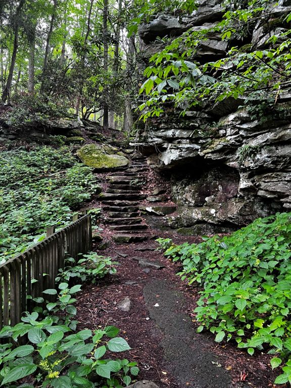
Sitting in the New River Gorge National River area, the Tunnel Trail begins at Grandview Park, a popular recreational area known for its stunning vistas and outdoor activities. The trailhead is easily accessible from the park's main parking lot, so access is super easy.
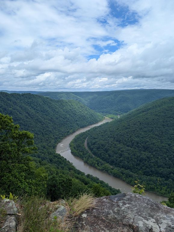
As you embark on the Tunnel Trail, you'll be greeted by breathtaking views of the New River Gorge and the surrounding Appalachian Mountains. The trail winds its way along the rim of the gorge, and the views just keep on coming!
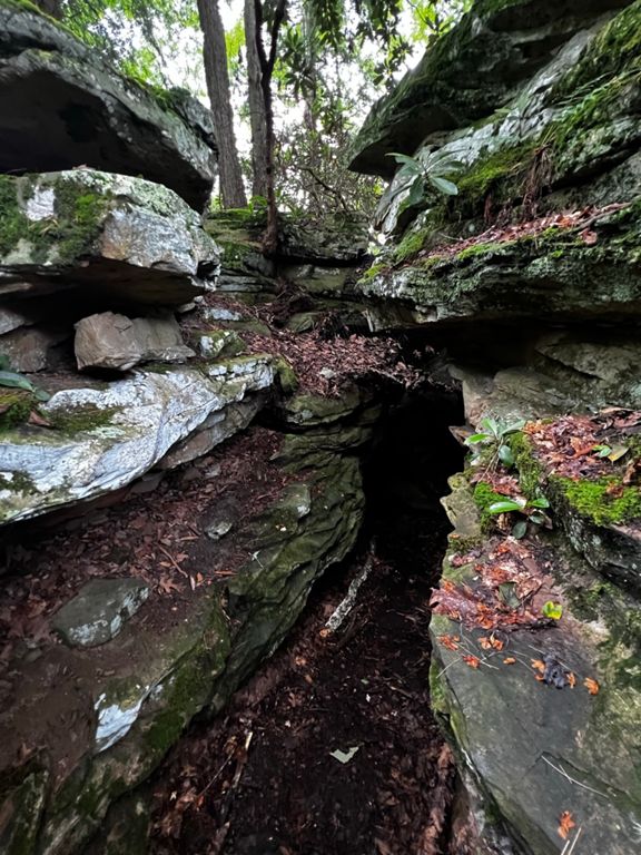
One of the highlights of the Tunnel Trail is the historic Keeneys Creek Trail Tunnel, a remnant of the area's coal mining past. The tunnel, which dates back to the early 20th century, was once used to transport coal from the mines to the nearby railroad. Today, it serves as a unique landmark and a fascinating glimpse into the region's industrial heritage.
The trail is never steep but it is rocky in places, so wear appropriate footwear, and don't forget your binoculars with which to observe the abundant wlidlife. Written by Charlie Boscoe
Sitting in the New River Gorge National River area, the Tunnel Trail begins at Grandview Park, a popular recreational area known for its stunning vistas and outdoor activities. The trailhead is easily accessible from the park's main parking lot, so access is super easy.
As you embark on the Tunnel Trail, you'll be greeted by breathtaking views of the New River Gorge and the surrounding Appalachian Mountains. The trail winds its way along the rim of the gorge, and the views just keep on coming!
One of the highlights of the Tunnel Trail is the historic Keeneys Creek Trail Tunnel, a remnant of the area's coal mining past. The tunnel, which dates back to the early 20th century, was once used to transport coal from the mines to the nearby railroad. Today, it serves as a unique landmark and a fascinating glimpse into the region's industrial heritage.
The trail is never steep but it is rocky in places, so wear appropriate footwear, and don't forget your binoculars with which to observe the abundant wlidlife. Written by Charlie Boscoe
