
The Best Hiking Trails in San Francisco, CA
Explore Hiking TrailsTrail adventures throughout the Bay Area
San Francisco and the surrounding bay area is an incredible place to get out in nature. Just north of the city, The Marin Headlands and Golden Gate National Recreation Area are a hiker’s paradise. Across the bay in Oakland, there are also a number of fantastic hiking trails.
If you’re looking to go straight to the best hikes in San Francisco, our data says to head to the headlands. These trails are where the locals go. For a beautiful and family friendly hike, we recommend the Tennessee Valley Trail. If you’re looking for a more challenging option, you can’t go wrong with the Rodeo Beach Loop. If Oakland is more your speed, Strava members love The Skyline Gate hike.
It’s our mission to help you explore the world around you. We use the data from millions of hikes to create accurate lists and trail maps so you can have a great time on trail. Have fun out there and be sure to share your adventure on Strava!
Top 16 hiking trails in San Francisco, CA
Page 1 of 1
1


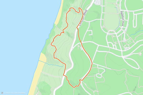
Tennessee Valley Trail
The Tennessee Valley Trail is a great hike in the Marin Headlands which takes you through a picturesque valley to an overlook of the stunning Tennessee Beach. For the most part, the trail is welcoming with good footing and plenty of space to walk side by side as a group. The trail follows an out and back route. Most consider this an easy trail which can be perfect for a full family outing. The Tennessee Valley Trail is one of the most popular hikes in the area for local Strava members
2


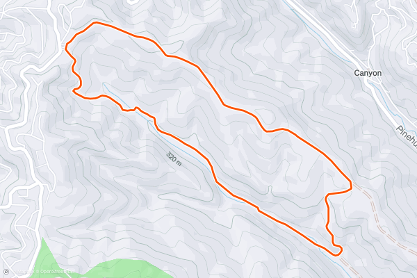
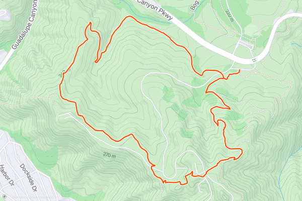
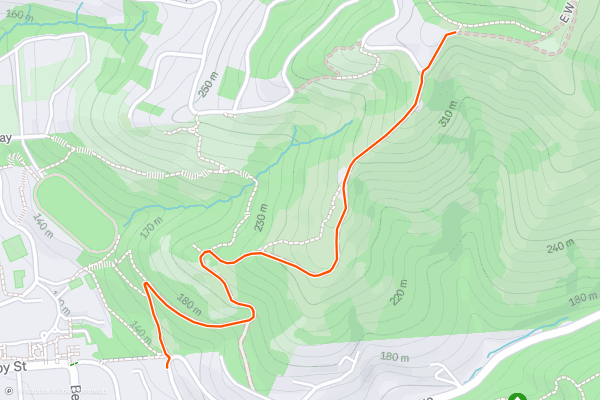
Skyline Gate Loop
The Skyline Gate Loop in Reinhardt Redwood Regional park is a stunning hike among the redwood groves of The East Bay. The trail passes a few spectacular viewpoints, but you’ll spend most of your time among the trees. Most consider this an easy trail, but the length may make it difficult depending on your hiking experience. This is one of the most popular hikes in the Bay Area with Strava members. There are also several options to extend this hike on the park's trail networks. It may be worth downloading the trail map ahead of time so you can adventure without getting lost!
3


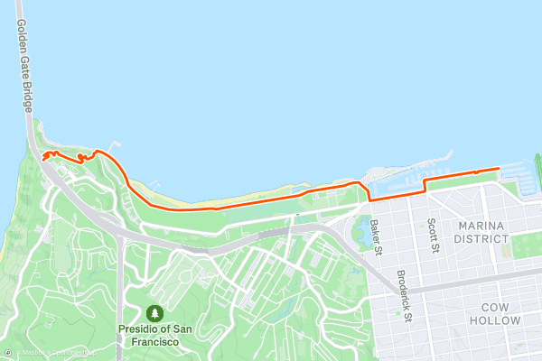
Golden Gate Promenade
The promenade provides a walking tour of San Francisco’s urban park next to the bay and the Golden Gate Bridge, with a wealth of activities to explore. One highlight is, of course, the view, but there are many more attractions along this waterfront....
4


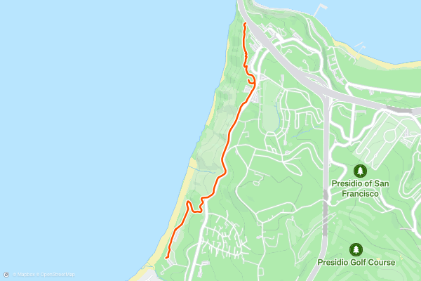
Coastal Trail: Baker Beach to Golden Gate Bridge
This section of the California Coastal Trail features some of the best views to be found in The Presidio. It is an easy walking and biking path from Baker Beach to the Golden Gate bridge, with intermediate access and car parking at points in between....
5


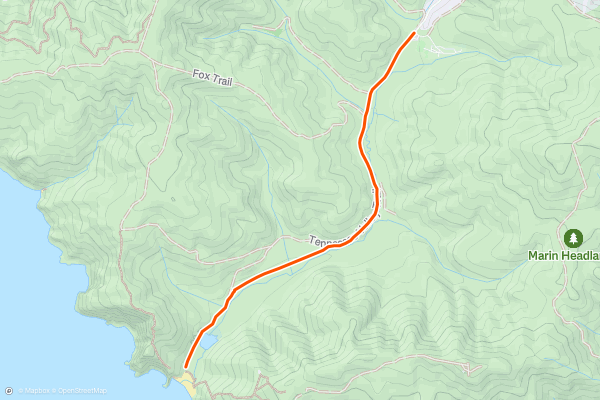
SCA Trail to Golden Gate Bridge Views
The SCA Trail in the Marin Headlands is one of the most spectacular ways to take in the Golden Gate Bridge. The headlands have many trails to offer so you can follow this exact route or use it as a jumping off point to visit popular sites like Slacker Hill or Kirby Cove. This hike follows an out and back route. There are some steep bits at the start, then it proceeds along a ridgeline with panoramic views. Most consider this a moderate hike. Get out and enjoy one of the most popular hikes in the area for Strava members.
6


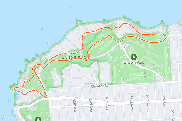
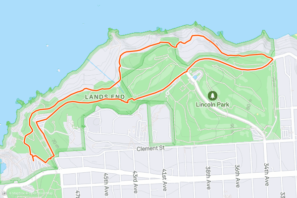
Lands End Loop
A short network of trails twists around the part of Golden Gate National Recreation Area known as Lands End. This far tip of San Francisco’s peninsula has incredible views of the ocean and the Golden Gate Bridge, tall sea cliffs, wind-warped cypress groves, historic ruins, and shipwrecks....
7


San Bruno Mountain: Summit Loop Trail
San Bruno Mountain is the pronounced ridgeline rising from the metro area near South San Francisco. Its summit and signal towers on top are visible from all around. Despite the development, this mountain is still a great hiking destination because of the sweeping views, intact ecosystem on its slopes, and convenient access from the city....
8


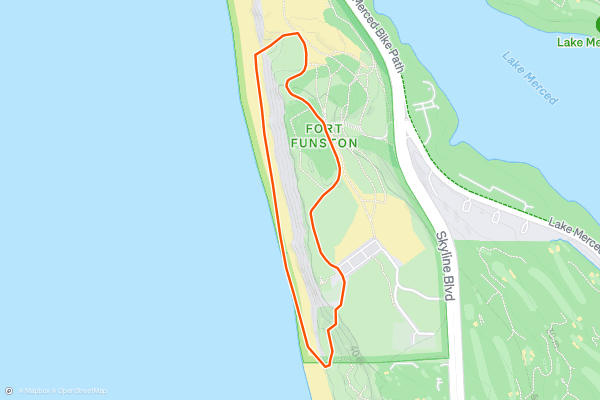
Fort Funston Beach Loop
Fort Funston, named for an old military installation, still has defense batteries that you can view up close, but today it's better known for natural scenery, including cliff-top views and hiking among sand dunes....
9


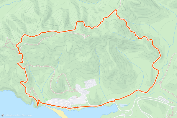
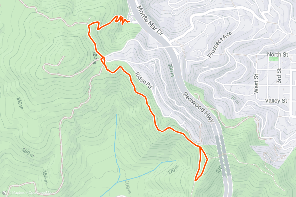
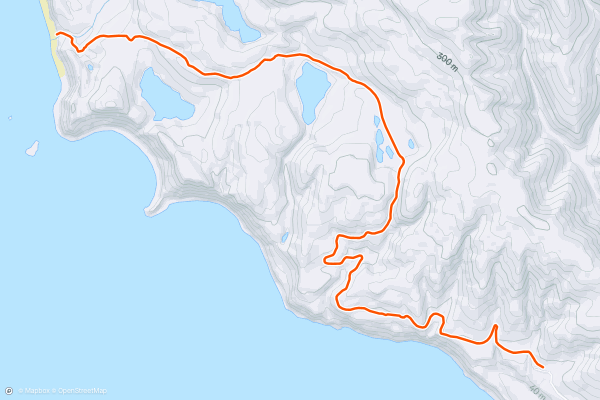
Rodeo Beach Loop
The Rodeo Beach Loop along the Miwok Trail, Wolf Ridge Trail, and Coastal Trail is a popular hiking route in the Golden Gate National Recreation Area. The trail begins near the Rodeo Beach Parking lot. You’ll begin walking east alongside Mitchell road, then up the Miwok trail, then down the Coastal trail to complete the loop. As you climb the ridges, you’ll enjoy some great views of the pacific and get the opportunity to visit some Cold War missile sites. This trail is generally considered hard and has some steep sections with wooden stairs. Grippy shoes or boots are a must. This is one of the most popular hikes in San Francisco among Strava Members.
10


Batteries to Bluffs Loop
Batteries to Bluffs Trail is an excellent tour of the scenery and history on the San Francisco coastline. It winds along seaside hills covered in colorful vegetation, crosses the walls of wartime defense structures, and reaches a beach with a picture-perfect view of the Golden Gate Bridge....
11


Stonewall Panoramic Trail
The Stonewall Panoramic Trail falls within the Claremont Canyon Regional Preserve and follows an out and back route. The trail is not particularly long, but there are steep sections, so you’re guaranteed to get a workout. This trail is popular with East Bay residents, San Francisco residents, and those visiting from out of town. If it’s not too foggy, you’ll be able to take in some great views of San Francisco across the water.
12


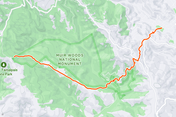
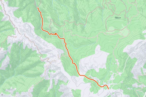
Dipsea Trail
The Dipsea Trail is home to America’s oldest trail race and takes you from the town of Mill Valley to beautiful views of the Pacific Ocean and Stinson Beach. Since the trail follows a point to point route, this hike follows the “Double Dipsea” out-and-back route. Because of its length and steep sections, most consider this a hard trail. Every San Francisco resident and visitor should complete the Dipsea Trail. This hike is one of the most popular in the area for Strava Members.
13


Coast Trail to Alamere Falls
The Coast Trail to Alamere Falls is one of the Marin Headlands' best day hikes. This route begins along the Coast Trail then takes the Alamere Falls trail to the beachside waterfall before returning to the start. The trail follows an out and back route. Because of the length, most consider this a hard hike. This trail is popular with Local Strava members. The base of the falls is a great place to stop for a snack with your hiking buddies!
14


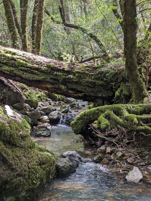

Cataract Trail to Cataract Falls
The Cataract Trail takes you through a lush section of the Mount Tamalpais Watershed to Cataract Falls, a set of small waterfalls and cascades. The trail follows an out and back route. Because of the length, most consider this a hard trail. There are several ways to access the falls, but this south up, out-and-back route along the cataract trail is the most popular with Strava members.
15


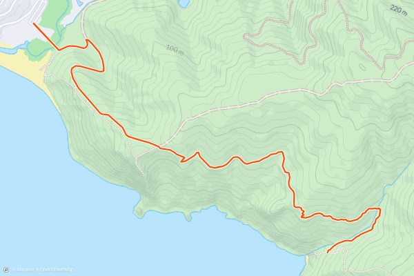
Coastal Trail to Pirates Cove
The Coastal Trail to Pirates Cove is a fun and welcoming hike in the Golden Gate National Recreation Area. This hike departs near muir beach and follows the coastal trail south towards Pirates Cove. The trail follows an out and back route. There are a few steep sections at the beginning, but the trail is well maintained and may be accessible for hikers of all abilities. Pirates Cove is a beautiful place to connect with nature and take in some beautiful ocean views. Be aware that if you’d like to go down to the beach, you might have to scramble over some slippery rocks.
16

Land's End Trail
The lands end trail is a stunning hiking route at the northwest corner of San Francisco. On a clear day, you’ll enjoy beautiful views of the pacific, the bay, The Golden Gate Bridge, and the Marin Headlands. The Lands End Trail is welcoming to hikers of all abilities, but there are some steeper sections with wooden stairs so be sure to wear appropriate footwear. Along the trail, you’ll pass by the legion of honor, the ruins of the Sutro Baths, and a memorial to the USS San Francisco.
There’s plenty of parking in the area, drive down El Camino Del Mar and look for parking along the side if the parking lot is full. Pro Tip: check out <a href="https://fog.today">fog.today</a> to make sure the great views won't be obscured by the fog.
Page 1 of 1
Top regions for hiking trails on Strava
- Acadia National Park
- Alabama
- Alaska
- Albuquerque
- Alyeska
- Angeles National Forest
- Arizona
- Arkansas
- Austin, TX
- Bay Area
- Bend
- Big Sky
- Blue Mountain Ski Area
- Boston
- Boulder, CO
- Brevard
- Bridger Bowl
- Buena Vista
- California
- Cape Cod
- Colorado
- Connecticut
- Dahlonega
- Downieville
- Ellijay
- Flagstaff
- Florida
- Georgia
- Glacier National Park (USA)
- Grand Teton National Park
- Great Smoky Mountains National Park, TN
- Hawaii
- Hurricane
- Hyalite
- Idaho
- Illinois
- Indiana
- Kansas
- Kentucky
- Lake Tahoe
- Las Vegas, NV
- Los Angeles, CA
- Maine
- Mammoth Mountain
- Marin County
- Maryland
- Massachusetts
- Maui, HI
- Michigan
- Minnesota
- Missouri
- Moab
- Montana
- Mount Rainier National Park
- Mt. Rainier National Park, WA
- Nederland
- Nevada
- New Hampshire
- New Jersey
- New Mexico
- New York
- New York, NY
- North Bridgers
- North Carolina
- North Dakota
- Oakridge
- Ohio
- Oklahoma
- Oregon
- Park City and Deer Valley
- Pennsylvania
- Phoenix, AZ
- Placitas
- Portland, OR
- Roanoke
- Salida
- Salt Lake City, UT
- San Diego, CA
- San Francisco, CA
- Santa Fe, NM
- Santa Monica Mountains
- Seattle, WA
- Sedona, AZ
- Sisters
- South Carolina
- South Dakota
- South Lake Tahoe, CA
- Stowe
- Sugarbush
- Sun Valley
- Taos
- Telluride
- Tennessee
- Texas
- Timberline Lodge Summer
- Utah
- Vermont
- Virginia
- Washington
- West Virginia
- Wind River Range
- Winter Park
- Wisconsin
- Wyoming
- Yellowstone National Park
- Yosemite National Park, CA
- Zion National Park, UT