
The Best Hiking Trails in Mt. Rainier National Park, WA
Explore Hiking TrailsTrail adventures on the slopes of Mt. Rainier
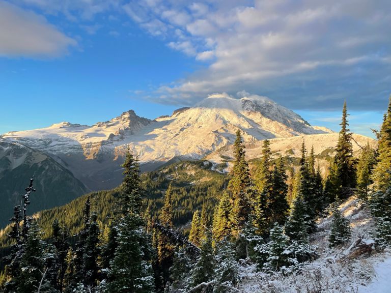
Looking for the best hikes in Mt. Rainier national park? Well, you don’t have to make a summit attempt on Mt. Rainier itself to have a great time on the trail. Here we’ve put together a list of the best trails in the park with views of iconic landmarks like Myrtle Falls, Carbon Glacier, and of course, lots of views of Mt. Rainier itself.
There are a large number of popular hiking trails in Mt. Rainier National park to choose from. If you’re looking for a family friendly option, try the Carter Falls Hike. If you’re looking for a more strenuous trail, The Tolmie Peak Trail is a great option.
At Strava, we use data from millions of hikes to make sure you have up to date and accurate trail information before you head out on trail. You can’t go wrong with any of these top hikes in Mt. Rainier national park.
Top 10 hiking trails in Mt. Rainier National Park, WA
Page 1 of 1
1


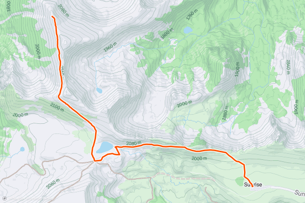
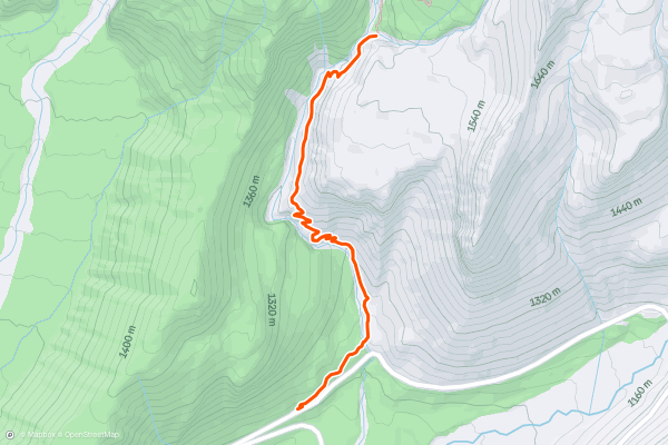
Mount Fremont Lookout Trail
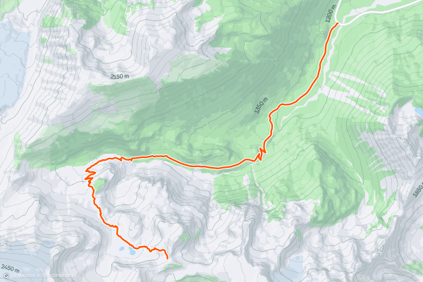
Take in views of Mount Rainier from the deck of a historic fire lookout. The Mount Fremont Lookout Trail takes you from the Sunrise Visitor Center to the Mount Fremont Fire Lookout, which was built by the National Park Service in 1933. The hike begins on the Sourdough Ridge trail. After about a mile and a half, you’ll turn right onto the Mount Fremont Lookout Trail and make your way to the lookout. The inside of the building is closed to the public, but it may be possible to climb the steps up to the deck. This trail follows an out and back route. Because of the high elevation and steep grades, most hikers consider this a hard trail. This is one of the most popular hikes for Strava members visiting Mount Rainier National Park.
2


The Skyline Trail
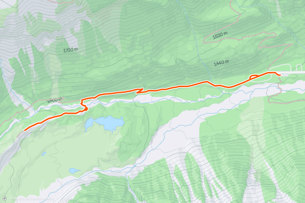
The Skyline Trail Loop has it all: glacier views, waterfalls, stunning valleys. It’s hard to imagine more beauty packed into a single hike. The trail begins at the Jackson Visitor Center. Most hikers proceed counterclockwise, but the clockwise route is also spectacular. Because of its length and total elevation gain, most hikers consider this a hard hike. The Skyline Trail Loop is one of the most popular hikes for Strava members visiting Mount Rainier National Park.
3


Tolmie Peak Trail
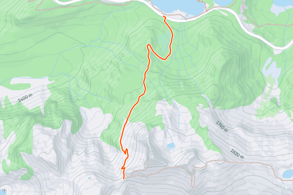
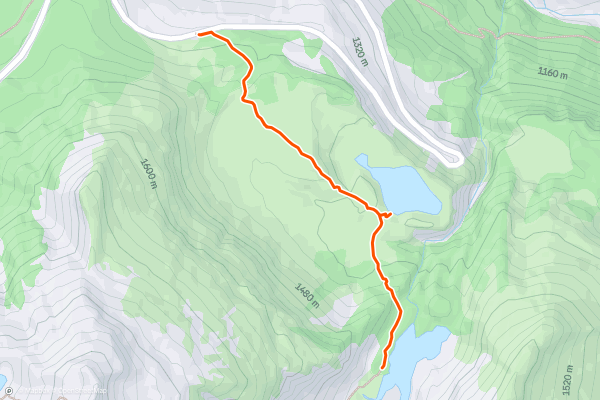
The Tolmie Peak Trail is one of the most spectacular hikes in the entire National Park System. You’ll travel from the shore of Mowich Lake to one of the park’s historic fire towers. The views from the tower, which sits on the summit of Tolmie Peak are so breathtaking that you’ll just have to go see it for yourself. The trail follows an out and back route. Because of the length and total elevation gain, most hikers consider this a hard hike. The Tolmie Peak Trail is one of the most popular hikes for Strava members visiting Mount Rainier National Park. The inside of the fire lookout is closed to the public, but it may be possible to climb the steps up to the deck.
4


Pinnacle Peak Trail
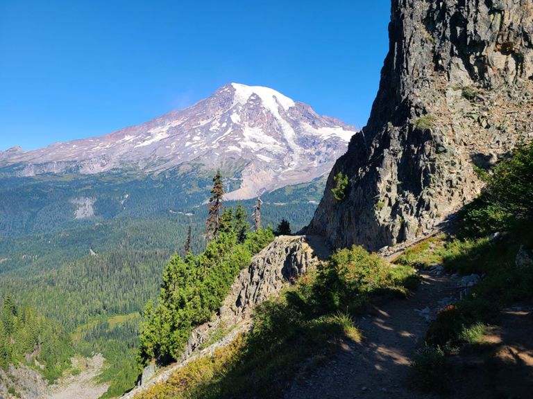
The Pinnacle Peak trail is a short but steep hike to a spectacular close up view of Mount Rainier. From the summit you’ll also be able to take in views of Paradise, Mount Saint Helens, Mount Adams, and, if the weather permits, Mount Hood in Oregon. The trail follows an out and back route. Because of the steep grades throughout, most hikers consider this a hard hike. The Pinnacle Peak trail is one of the most popular hikes for Strava members visiting the park. The National Park Service advises that hikers wear sturdy footwear with ample grip as this trail often has snow on the top year round.
5


Rampart Ridge Trail
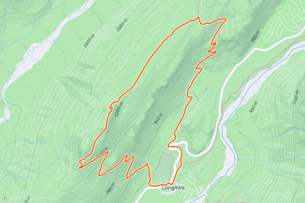
The Rampart Ridge Trail is a scenic loop of “The Ramparts,” an ancient lava flow which once erupted from the summit of Mt. Rainier. Most hikers take the loop in the clockwise direction. This route begins with steep switchbacks before proceeding around a scenic ridge on your way back to the start point. Because of the occasionally steep grades, this is generally considered a hard hike. The Rampart Ridge Trail is a popular hike with Strava members visiting Mt. Rainier National Park.
6


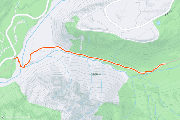
Emmons Moraine Trail
The Emmons Moraine Trail is a fun hike with great views of Mount Rainier’s largest glacier. The Emmons Glacier is massive, with more than 2 miles from its peak to its lowest point and over 4 square miles of surface area. The trail follows an out and back route. Because the trail involves some clambering over rocks and a few wooden staircases, most hikers consider this a hard route. This is a popular trail with Strava members visiting Mount Rainier National Park.
7


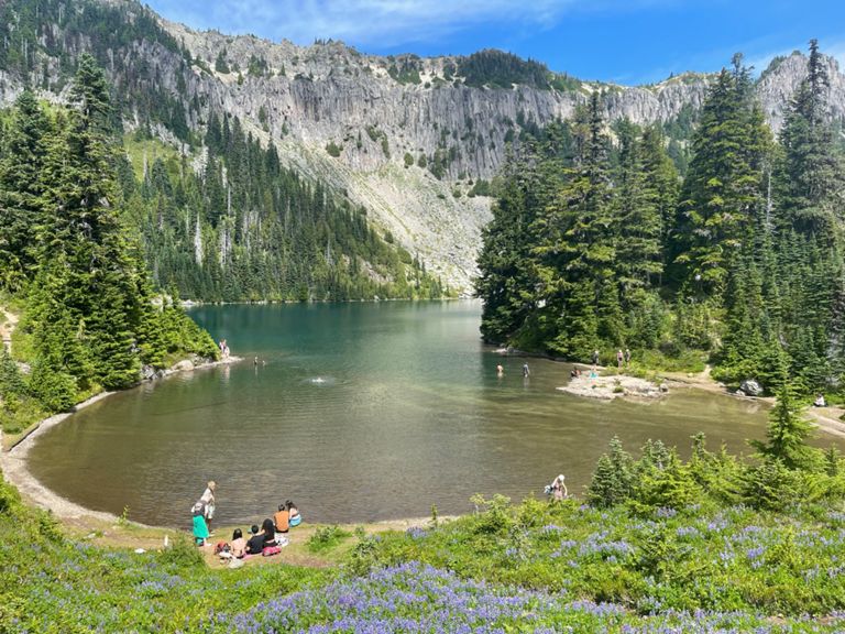
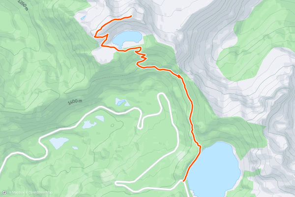
Bench and Snow Lake Trail
Walk the shores of two alpine lakes on this short, stunning trail. The Bench and Snow Lake Trail passes both Bench Lake and Snow Lake, which are two of the most photographed lakes in the park. The trail follows an out and back route. This is a popular hike with Strava members visiting Mount Rainier National Park. You’ll also enjoy some great views of Mount Rainier along the way.
8


Summerland Trail
The Summerland Trail has it all. Creeks, wildflower meadows, and stunning mountain views wait for you to enjoy. This is one of the most popular day hikes on the slopes of Mount Rainier. The trail follows an out and back route. Because of its length and steep sections, most hikers consider this a hard hike. The famous mountain climber E. S. Ingraham came up with the name for this beautiful section of the park. You can shorten or extend this route to help it fit your day, the shown distance is popular, but you can easily extend to 10+ miles or shorten the hike.
9
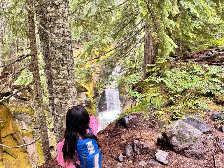


Comet Falls Trail
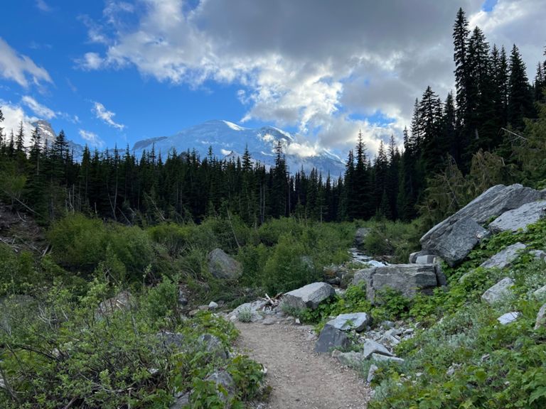
Check out a series of glacier fed waterfalls on the scenic Comet Falls Trail. After leaving the Comet Falls Parking Lot, you’ll pass over Van Trump creek and get the opportunity to view Christine Falls down stream. As you continue on, you’ll arrive at views of Comet Falls, which is fed by the glaciers above. This trail follows an out and back route. It’s well maintained but has several steep sections. This is a popular trail for Strava members visiting Mount Rainier National Park.
10


Carter Falls via Wonderland Trail
This route to Carter Falls is an easy hike to a 50 foot tall waterfall with views of Mount Rainier. Just over a mile each way, this trip to Carter Falls is great for the whole family. You’ll proceed along the Wonderland Trail on the shore of the Paradise River before reaching the falls. This hike follows an out and back route. Most hikers consider this an easy route. This is one of the more popular easy hikes for Strava members visiting Mount Rainier National Park.
Page 1 of 1
Top regions for hiking trails on Strava
- Acadia National Park
- Alabama
- Alaska
- Albuquerque
- Alyeska
- Angeles National Forest
- Arizona
- Arkansas
- Austin, TX
- Bay Area
- Bend
- Big Sky
- Blue Mountain Ski Area
- Boston
- Boulder, CO
- Brevard
- Bridger Bowl
- Buena Vista
- California
- Cape Cod
- Colorado
- Connecticut
- Dahlonega
- Downieville
- Ellijay
- Flagstaff
- Florida
- Georgia
- Glacier National Park (USA)
- Grand Teton National Park
- Great Smoky Mountains National Park, TN
- Hawaii
- Hurricane
- Hyalite
- Idaho
- Illinois
- Indiana
- Kansas
- Kentucky
- Lake Tahoe
- Las Vegas, NV
- Los Angeles, CA
- Maine
- Mammoth Mountain
- Marin County
- Maryland
- Massachusetts
- Maui, HI
- Michigan
- Minnesota
- Missouri
- Moab
- Montana
- Mount Rainier National Park
- Mt. Rainier National Park, WA
- Nederland
- Nevada
- New Hampshire
- New Jersey
- New Mexico
- New York
- New York, NY
- North Bridgers
- North Carolina
- North Dakota
- Oakridge
- Ohio
- Oklahoma
- Oregon
- Park City and Deer Valley
- Pennsylvania
- Phoenix, AZ
- Placitas
- Portland, OR
- Roanoke
- Salida
- Salt Lake City, UT
- San Diego, CA
- San Francisco, CA
- Santa Fe, NM
- Santa Monica Mountains
- Seattle, WA
- Sedona, AZ
- Sisters
- South Carolina
- South Dakota
- South Lake Tahoe, CA
- Stowe
- Sugarbush
- Sun Valley
- Taos
- Telluride
- Tennessee
- Texas
- Timberline Lodge Summer
- Utah
- Vermont
- Virginia
- Washington
- West Virginia
- Wind River Range
- Winter Park
- Wisconsin
- Wyoming
- Yellowstone National Park
- Yosemite National Park, CA
- Zion National Park, UT