
The Best Hiking Trails in Phoenix, AZ
Explore Hiking TrailsTrail adventures just a few minutes from downtown
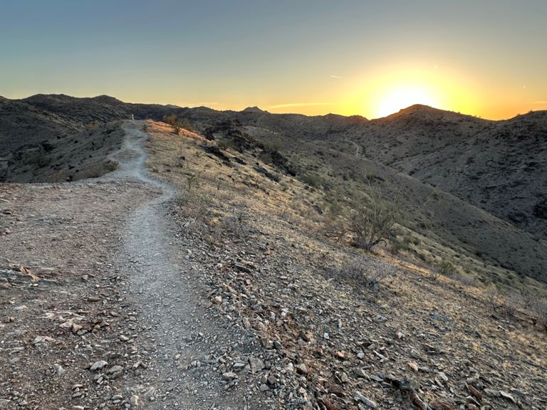
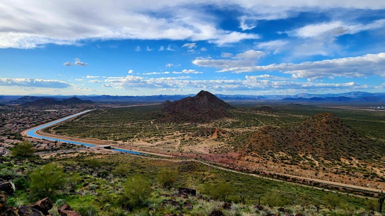
Phoenix is a fantastic city for hikers. With South Mountain Preserve just south of the city, The Phoenix Mountains Preserve to the north, and Camelback Mountain in the middle, there are so many hiking trails just a short drive away from downtown. We used data from the community to determine the best hikes in Phoenix Arizona.
Here’s what we found. If you’re looking for a classic phoenix hike with great views of the city, we recommend Piestewa Peak. This is one of the most popular hiking routes in the world for Strava members, so you might make some friends. If you’re looking for a more family friendly option, Telegraph Pass is worth checking out.
It’s our mission to help you explore the world around you. We use the data from millions of hikes to create accurate lists and trail maps so you can have a great time on trail. Be sure to share your adventure on Strava!
Top 10 hiking trails in Phoenix, AZ
Page 1 of 1
1


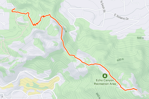
Camelback Mountain Via Echo Canyon Trail
The Echo Canyon Trail to the summit of Camelback Mountain is a popular hike with great views at the summit. The trail follows an out and back route. The trail is on the shorter side, but there are a few steep sections near the summit. For this reason, most consider it a hard hike. This is one of the most popular hikes in the area with Strava members, so let the Kudos flow. At the summit you’ll enjoy great views of Phoenix, Scottsdale, and the surrounding area.
2


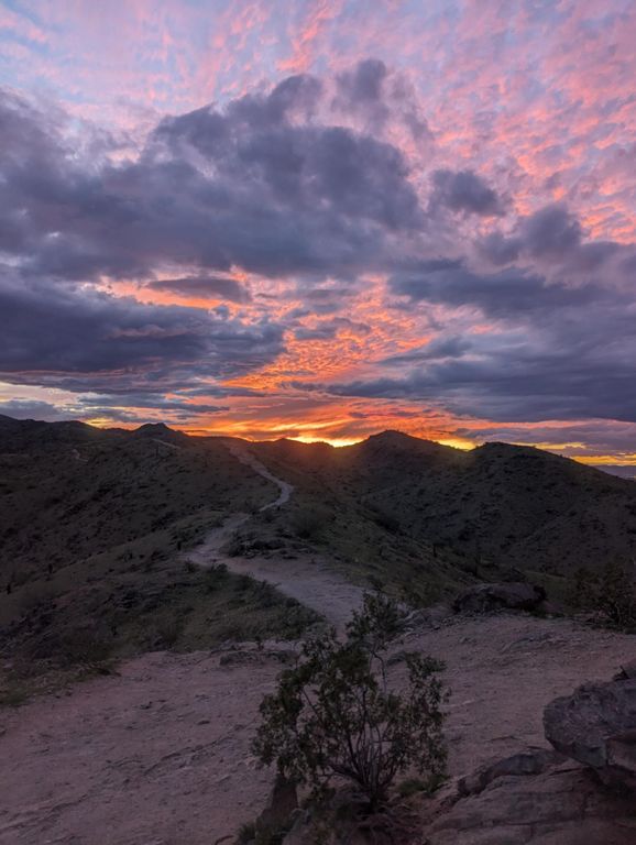
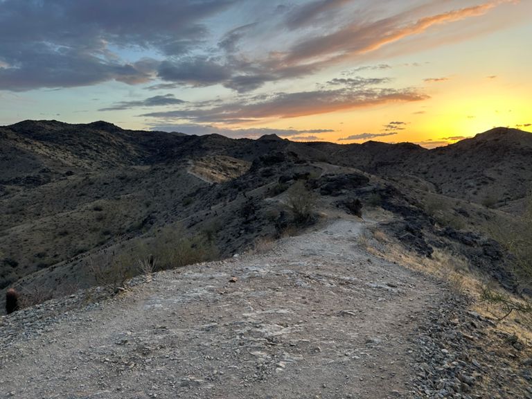
Piestewa Peak
The Piestewa Peak hiking trail is a steep and rewarding hike with great summit views just outside Phoenix. The trail follows an out and back route with several challenging switchbacks. Because of the sections with steep grades, most consider this a hard hike. Piestewa Peak is one of the most popular hikes in the area with Strava members. Pro Tip: the summit is a popular place to watch the sunset on a clear day, just bring a powerful flashlight or headlamp for the way down!
3


South Mountain Loop Trail
The South Mountain Loop Trail is a welcoming hike in the South Mountain Preserve just south of Phoenix. The trail is paved in sections and is fun for hikers of all abilities. The trail follows a loop route. Because of the gentle terrain and relative lack of steep grades, most consider this to be an easy hike. This is one of the most popular hikes with local Strava members.
4


Mormon Trail
The Mormon Trail is a popular and challenging hike that connects with several other hiking trails near Phoenix, Arizona. The trail follows an out and back route. Because of the steep grades, most hikers consider this a hard trail. After about a mile, the Mormon Trail intersects with the Hidden Valley loop trail. This adds about a mile and a half to the hike, and includes fun landmarks like The Hidden Valley Natural Tunnel as well as Fat Man’s pass (a narrow pass between two boulders.) This hike is popular with Strava members, so you’re sure to have an enjoyable time.
5


Telegraph Pass Trail
The Telegraph Pass trail is a welcoming hike in the South Mountain Preserve near Phoenix. This hike is popular with families as well as trail runners because of its more manageable terrain. The trail follows an out and back route, and most consider this an easy trail. It may be less difficult, but it’s no less rewarding. You’ll be treated to great views of the city and a lush natural landscape throughout the hike.
6


Gateway Loop Trail
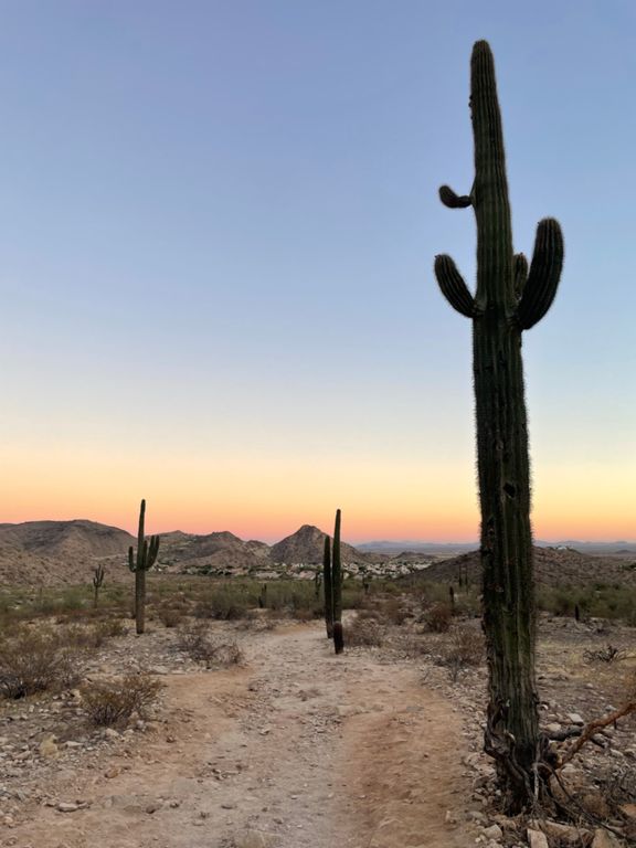
The Gateway Loop Trail is a fun, cactus filled hike in the McDowell Sonoran Preserve a short drive from downtown Phoenix. The trail follows a loop route. Because of its length and a few steeper sections, most hikers consider this a moderate hike. This hike is popular with Strava members in the Phoenix area. There is an abundance of Saguaro cacti on this trail, so be sure to snap a photo and share your adventure on Strava.
7


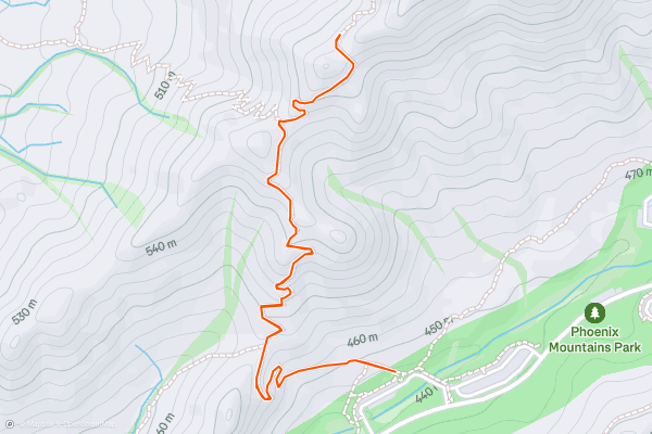
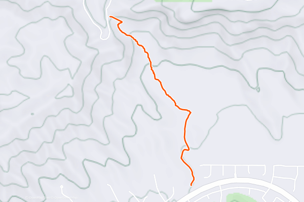
Dixie Peak Trail
The Dixie Peak Trail, also known as the Two Bit Peak Trail, is a fun and challenging hike with memorable switchbacks in the Phoenix Mountains Preserve. The trail follows an out-and-back route. Because of the steep sections near the summit, most consider this a hard hike. This hike is popular with Strava Members in the Phoenix and Scottsdale area. At the summit you’ll enjoy amazing views of the area and the nearby Camelback Mountain.
8


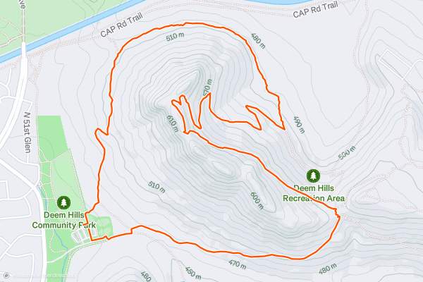
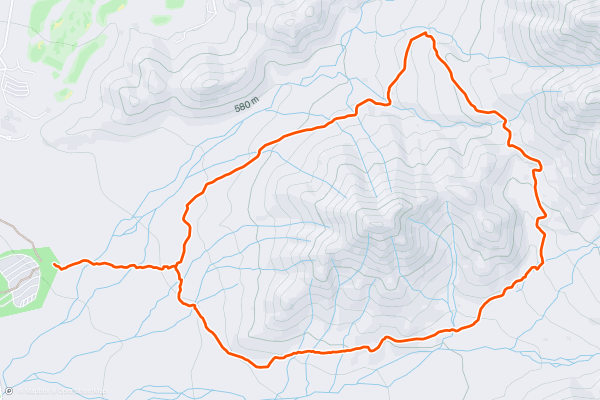
Deem Hills Hike
The Deem Hills Hike, which combines the Circumference Trail and the Ridgeline Trail is a popular hike just north of downtown Phoenix. There are a number of trails to choose from in the Deem Hills Recreation Area, but this is the route that Strava members tend to take. The trail follows a loop route, and most consider this to be a moderate trail. This hike is popular with local Strava members and has a number of pretty viewpoints along the way.
9


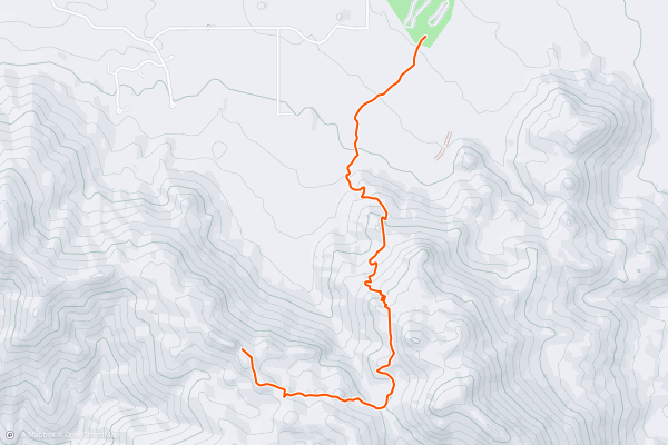
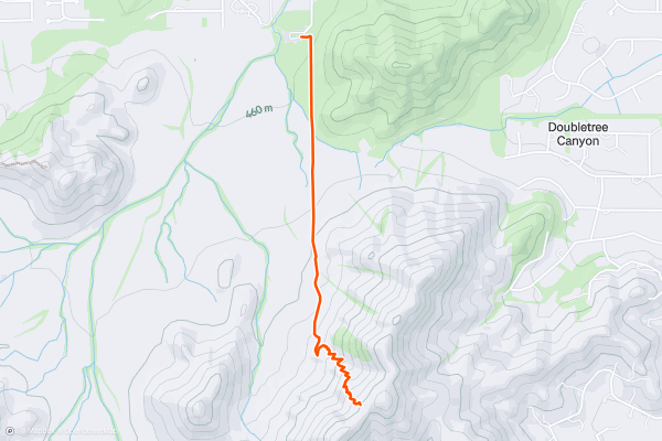
Tom's Thumb Trail
The Tom’s Thumb Trail is a rewarding hike up an iconic local peak with great views at the summit. Hikers will navigate a steep section then proceed along a ridge to The Lookout viewpoint. The trail follows an out-and-back route. Because of the steep sections, most consider this to be a hard hike. This trail is very popular with Strava members in the Phoenix and Scottsdale area. Check out the photos below to get a sense of the great views you’ll find at the summit.
10


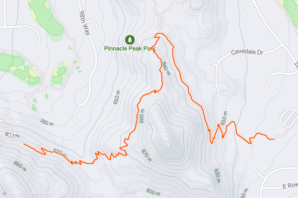
Pinnacle Peak Trail
The Pinnacle Peak Trail is a fun hike over rolling hills just east of downtown Phoenix. After about half a mile of ascending, you’ll reach the Pinnacle Peak Lookout Point where you can take in some nice views of the surrounding area. Most Strava members choose to continue on another half mile before turning back around. The trail as shown follows an out and back route. With the gently rolling hills, most hikers consider this an easy trail. This hike is popular with Strava members in the Phoenix area.
Page 1 of 1
Top regions for hiking trails on Strava
- Acadia National Park
- Alabama
- Alaska
- Albuquerque
- Alyeska
- Angeles National Forest
- Arizona
- Arkansas
- Austin, TX
- Bay Area
- Bend
- Big Sky
- Blue Mountain Ski Area
- Boston
- Boulder, CO
- Brevard
- Bridger Bowl
- Buena Vista
- California
- Cape Cod
- Colorado
- Connecticut
- Dahlonega
- Downieville
- Ellijay
- Flagstaff
- Florida
- Georgia
- Glacier National Park (USA)
- Grand Teton National Park
- Great Smoky Mountains National Park, TN
- Hawaii
- Hurricane
- Hyalite
- Idaho
- Illinois
- Indiana
- Kansas
- Kentucky
- Lake Tahoe
- Las Vegas, NV
- Los Angeles, CA
- Maine
- Mammoth Mountain
- Marin County
- Maryland
- Massachusetts
- Maui, HI
- Michigan
- Minnesota
- Missouri
- Moab
- Montana
- Mount Rainier National Park
- Mt. Rainier National Park, WA
- Nederland
- Nevada
- New Hampshire
- New Jersey
- New Mexico
- New York
- New York, NY
- North Bridgers
- North Carolina
- North Dakota
- Oakridge
- Ohio
- Oklahoma
- Oregon
- Park City and Deer Valley
- Pennsylvania
- Phoenix, AZ
- Placitas
- Portland, OR
- Roanoke
- Salida
- Salt Lake City, UT
- San Diego, CA
- San Francisco, CA
- Santa Fe, NM
- Santa Monica Mountains
- Seattle, WA
- Sedona, AZ
- Sisters
- South Carolina
- South Dakota
- South Lake Tahoe, CA
- Stowe
- Sugarbush
- Sun Valley
- Taos
- Telluride
- Tennessee
- Texas
- Timberline Lodge Summer
- Utah
- Vermont
- Virginia
- Washington
- West Virginia
- Wind River Range
- Winter Park
- Wisconsin
- Wyoming
- Yellowstone National Park
- Yosemite National Park, CA
- Zion National Park, UT